The world's simplest
GIS platform
What used to take days in GIS now takes seconds. Just type what you need.

ShapefileGeoJSONGeoPackageGeoTIFFCSVKML
See it in action
Just three steps — upload your data, type what you need, and the map updates.
Vector
Classify airports by type — major red, mid orange, small yellow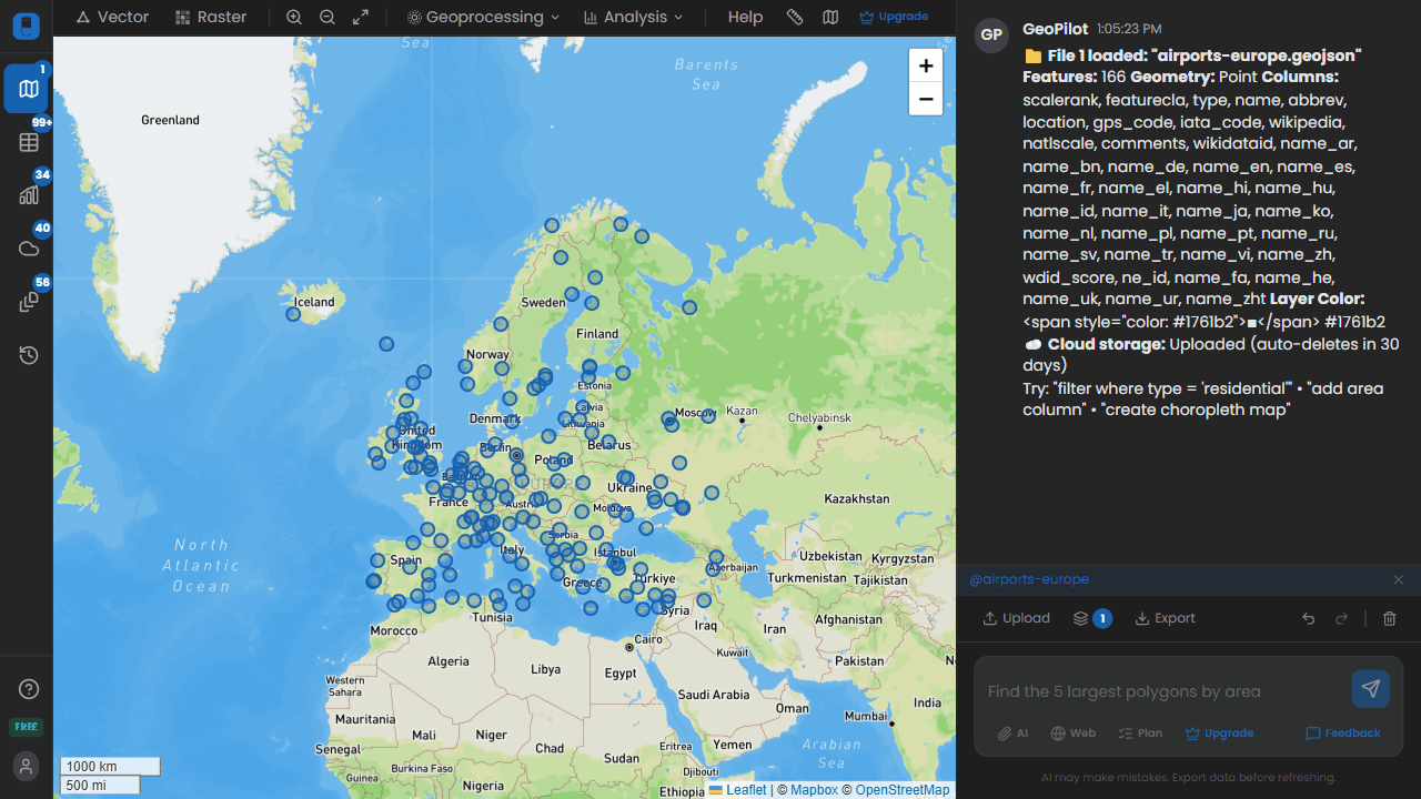
Airport classification by typePoints
Color railroads by scalerank using red to blue gradient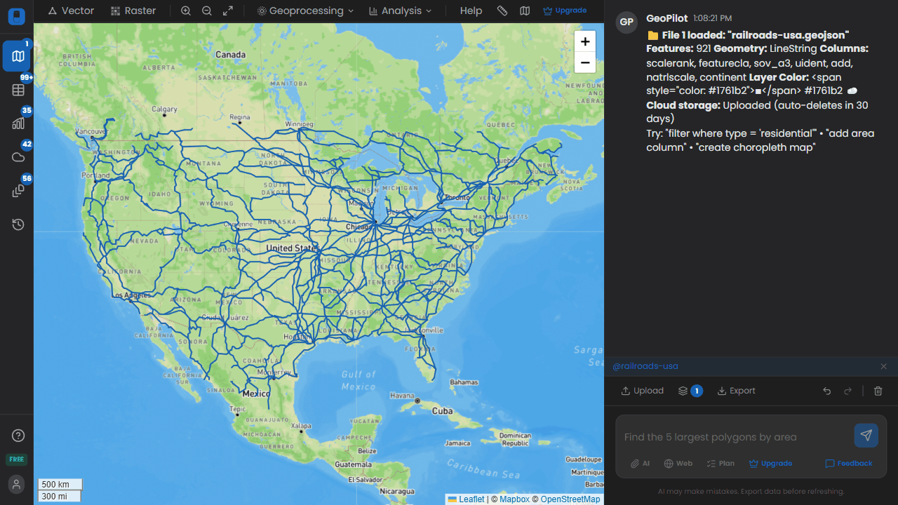
Railroad network stylingLines
Raster
Classify into 5 elevation bands
Elevation classification
Generate a hillshade from this DEM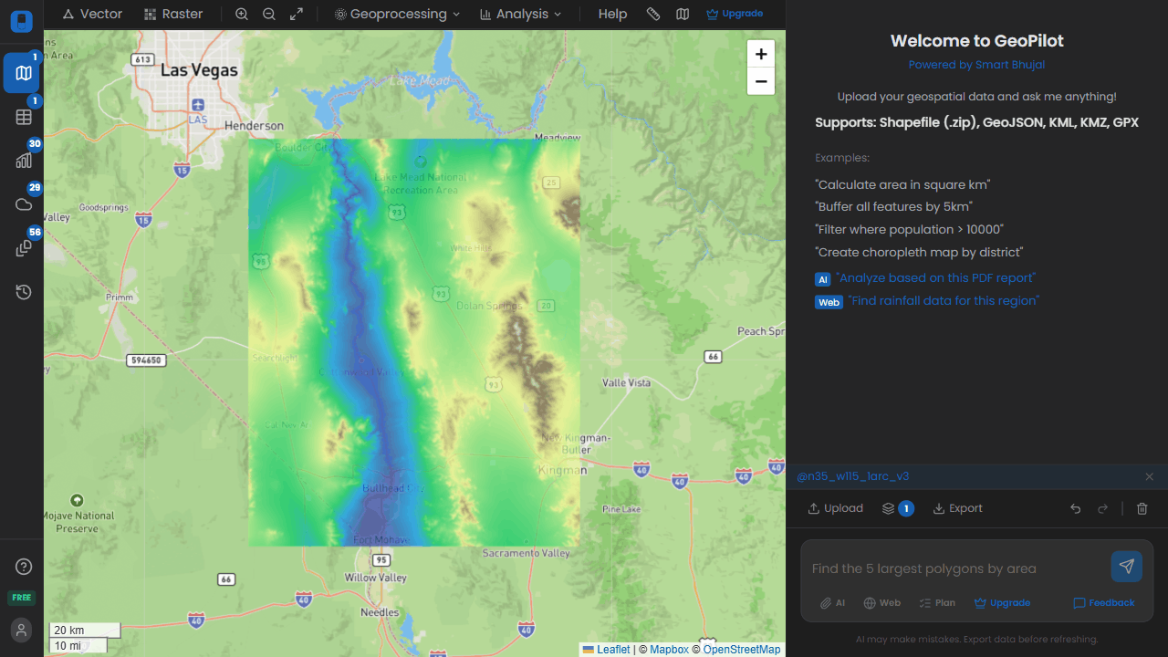
Hillshade generation
Buffer, clip, dissolve, spatial joins, watershed delineation, flow accumulation, and many more operations supported.
Things you can ask

Water Resources
>Map groundwater depth across districts
>Identify areas with declining water tables
>Delineate watershed boundaries from DEM

Urban Planning
>Classify zones by population density
>Show urban vs rural areas on the map
>Calculate built-up area percentage per district

Environment
>Show flood risk zones in red
>Identify areas near protected habitats
>Calculate forest cover percentage

Agriculture
>Color regions by average rainfall
>Filter areas suitable for rice cultivation
>Map irrigation canal coverage

Infrastructure
>Create 5km buffer around hospitals
>Find areas more than 10km from a road
>Calculate service area coverage for schools

Real Estate
>Filter parcels between 50-200 density and income above 40k
>Show distance to nearest metro station
>Identify high-value zones by median income
Enterprise
GeoPilot Desktop
For organizations that require offline access, on-premise deployment, and full data sovereignty. The same platform, as a native application.
Offline-first
On-premise deployment
Local processing
File system access
Priority support
Custom model integration
GeoPilot Desktop
Pricing
Start free, upgrade when you need more.
MonthlyYearly
All features included. Only pay for more prompts.
Free
$0
forever
20
prompts/month
Starter
$19$10
/user/mo
200
prompts/month
Popular
Pro
$39$20
/user/mo
1,000
prompts/month
Business
$99$49
/user/mo
Unlimited
prompts/month
All plans include:
All GIS operations (buffer, clip, dissolve, etc.)
Multi-file support & spatial joins
File upload for AI context
Web search grounding
Export GeoJSON, Shapefile, CSV
Map & attribute table views
Enterprise / Desktop
On-premise deployment, custom datasets, SLA guarantee
Ready to get started?
20 free prompts. No credit card required.